ePlatMaps Interactive Map
  • Features
  • Map Examples
    • Interactive Maps
    • Artist Renderings
  • Plans & Pricing
  • Get a Quote

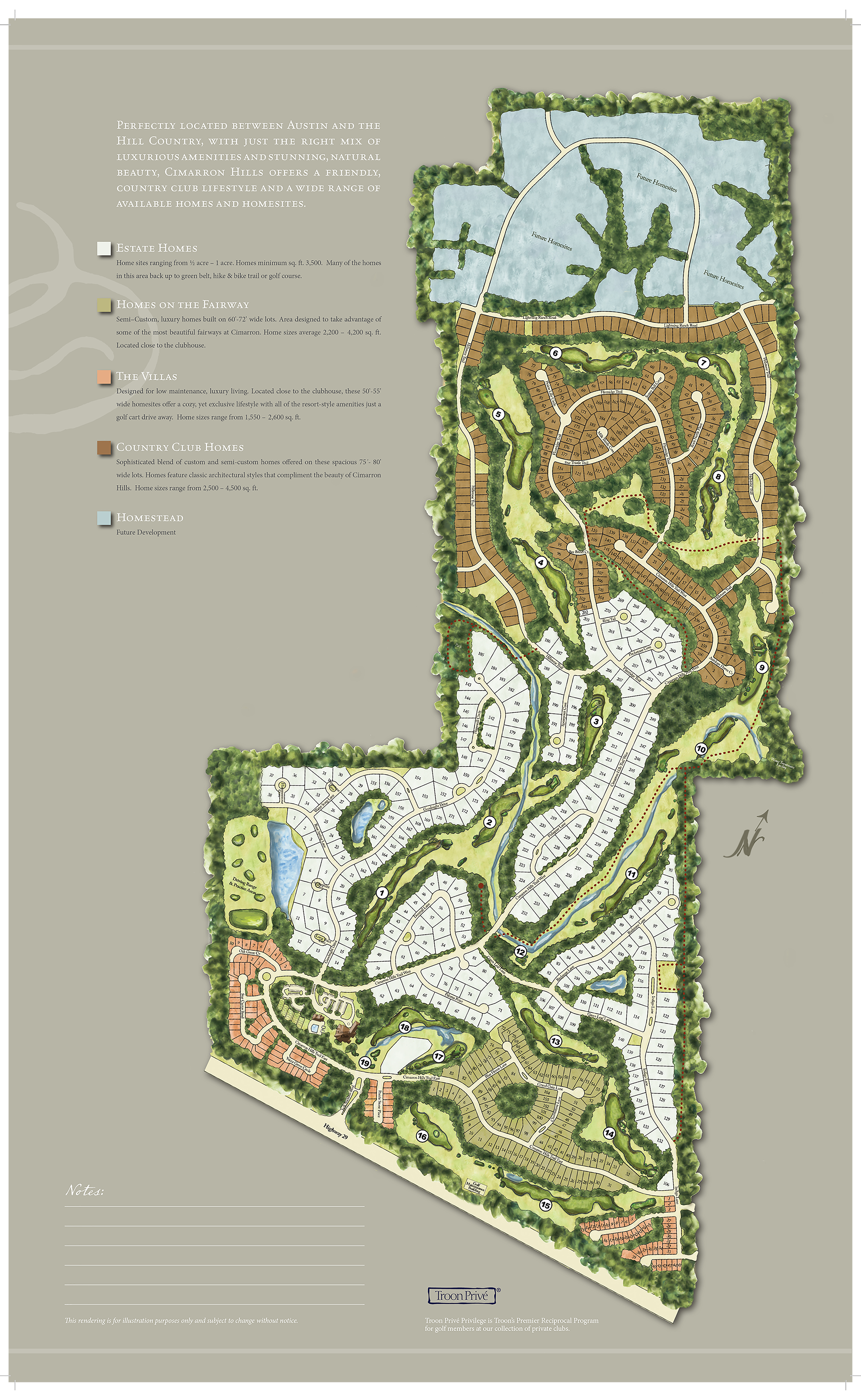
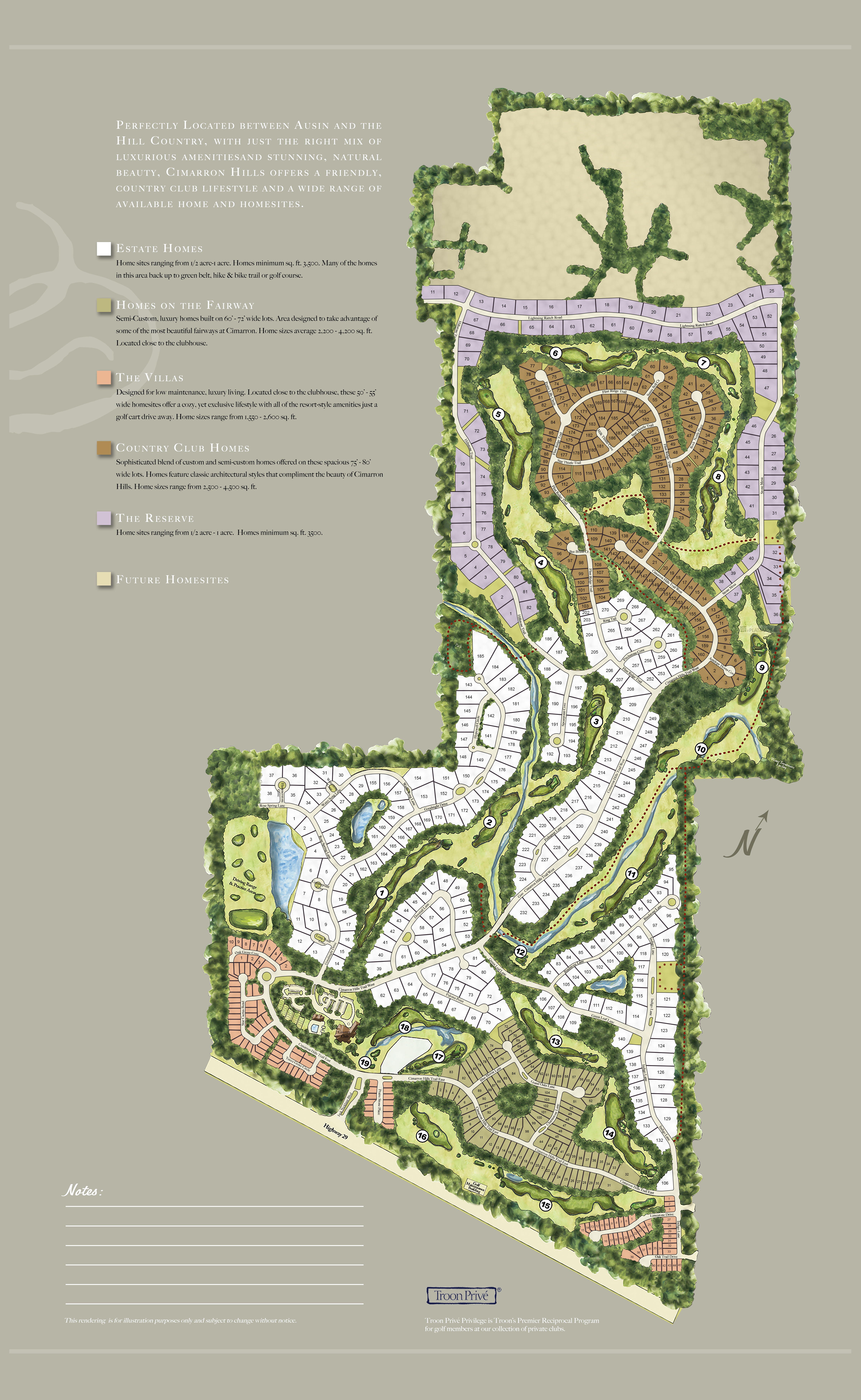
Before and After of ePlatmaps Interactive Plat Maps

Here we have a client that had a pre-existing marketing piece that needed to be updated with a new phase. We were asked to keep the original artwork and rework the new section into the map and make it full-bleed for the printer. When you slide the toggle left to right you can see the before and after results.

While reconstruction was underway we we asked to then change the future development section from the original blue to a beige, add colorize brown roofs on the the existing lots so that the lot numbers were legiable and to increase the size 16x26 inches for printing marketing materials.

Compare the Sales Plans by sliding bottom toggle to the left and right. The original sales plan will be revealed to show you the before when you slide to the right.

Share

ePlatMaps Feature Overview

  • Feature Overview
  • Website Integration
  • Artist Rendering
  • Additional Web Services
  • Map Examples
  • F.A.Q.

Pricing / Quote

  • Plans & Pricing
  • Quote Request

Industry Applications

  • Residential Marketing
  • Real Estate Brokers
  • Community Developers
  • New Home Builder
  • Commercial / Offices
  • Home Owner Associations
  • @eplatmaps
  • @eplatmaps
  • @eplatmaps
  • @eplatmaps

ePlatMaps Interactive Maps WebAPP Overview

ePlatMaps Interactive Map Software

ePlatMaps Interactive Map Software Application is a program from the CO2 Consulting Group, Inc.

  • ePlatMaps
    PO BOX 99644
    Raleigh, NC 27624
  • eMail
  • 919-827-4689
Copyright © 2000-2023 ePlatMaps Interactive Plat Maps. All rights reserved.
Raleigh, North Carolina • (919) 827-4689